Hurricane Season Travel Tools
9 June 2011Web Sites
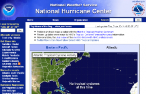 The National Hurricane Center
The NHC is the place to find the latest official tropical storm forecasts and warnings issued by the U.S. government. It includes current satellite maps for both the Atlantic and the Pacific. It has numerous resources and historical data going back to the 1800s. The NHC site is easy to use and has mobile versions for easy access to the latest storm info, official advisories, and marine forecasts.
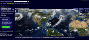
Stormpulse
Stormpulse reduces weather risk for a broad range of industries including energy, transportation, defense, healthcare, and retail. Businesses and government agencies subscribe to Stormpulse to improve their long-range planning and daily decision-making surrounding the arrival and impact of significant weather events in the continental United States and Caribbean.
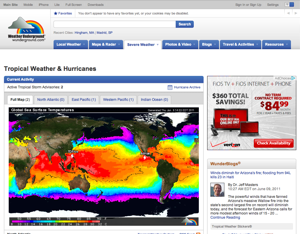
 Wunderground
Weather Underground is committed to delivering the most reliable, accurate weather information possible. Their state-of-the-art technology monitors conditions and forecasts for locations across the world, so you’ll always find the weather information that you need.
In addition to providing free, real-time online weather information to millions of Web users around the world, Weather Underground is pleased to offer a variety of Newspaper Weather Services and Custom Site Weather Packages.
iPhone Apps
 Hurricane Tracker
$2.99 iTunes Store
Formats: iPhone, iPad
Hurricane Tracker is the first iOS tracking app to bring complete push alerts. Not just for new storms (as the other apps do), but also for watches/warnings, intensity changes and other important messages.
Hurricane Tracker delivers the latest Atlantic, Caribbean Sea, Gulf of Mexico and Eastern Pacific Hurricane information to your iPhone and iPod Touch.
Stay up to date with nature’s fiercest storms through advisories, audio updates, video updates, animated satellite maps, official tracking maps and even the latest computer models for any Atlantic or Eastern Pacific based storm.
 Hurricane
$3.99 iTunes Store
Formats: iPhone, iPad (Hurricane HD)
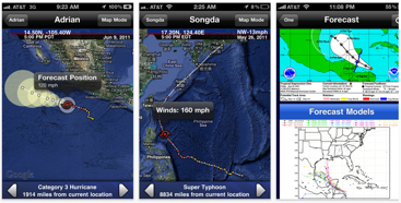
Features: Atlantic and Pacific Basin Interactive Tracking Map with storm data, generated on your device as it becomes available, throughout the hurricane season.Tracking map that is not just an image, but an interactive tracking map which allows you move between tracks, viewing each plot’s detailed information including wind speed with the icon, and lat/lon, speed/direction, pressure, date and time in the tab bar.Learn more about past hurricanes like Camile, Hugo, Andrew and Katrina, just to name a few. All hurricanes back to 1851 in the Atlantic, and 1949 in the Pacific are available!Internet Connection required to receive new plots and view new satellite pages and text bulletins.
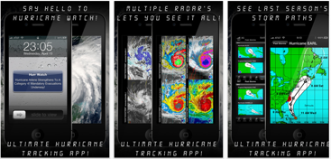
 Hurricane Watch w/Push Notifications
$1.99 iTunes Store
Formats: iPhone
Top reasons to buy “Hurricane Watch” over the competition!
The Fastest At Getting Critical Pushes Out!We Treat Tracking Hurricanes Seriously!Push Notifications Directly From The NHC!Best User Interface, Graphics & Functionality!Solid, Bug Free & No Crashing!No Nonsense Approach To Data You Want!Satisfaction Guaranteed!
We have packed in the best regularly updated data into a very attractive easy to read user interface you would come to expect from a great hurricane app! You won’t be disappointed! We promise!
Are you interested in tracking/watching hurricanes, tropical storms, and even typhoons make their across the ocean? Then Hurricane Watch is just that app! With Hurricane Watch you will be armed with all of the latest data from the best sources on earth. In addition you will be able to view multiple animated high resolution satellite & radar images for all current storms. Did you miss a storm? Well Hurricane Watch also has you covered there as well. Hurricane Watch includes past hurricanes and tropical storms all with animated maps detailing the path they took from start to finish.
Tweets
The NOAA recently implemented an experimental twitter feed for hurricane information.
A tweet will be sent whenever NHC issues:
- A public advisory regarding a tropical cyclone (TCP)
- A tropical cyclone update (TCU)
- A position estimate (TCE)
- A tropical weather outlook (TWO)
The National Hurricane Center has two Twitter accounts: one for the Atlantic basin (which includes the Gulf of Mexico and the Caribbean Sea) and one for the Eastern North Pacific basin. See this page for more information and to sign up.
Damian Tysdal is the founder of CoverTrip, and is a licensed agent for travel insurance (MA 1883287). He believes travel insurance should be easier to understand, and started the first travel insurance blog in 2006.
 Hurricane
 Hurricane Watch w/Push Notifications