Check Out Hurricane Maps Tracked By The National Hurricane Center
Read the guide: Does Travel Insurance Cover Hurricanes? The Complete Guide
What is the Best Hurricane Tracking Website?
The National Hurricane Center tracks all tropical storms throughout the year and they make their data available to everyone.
Points of origin for hurricanes
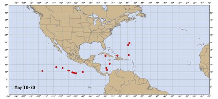
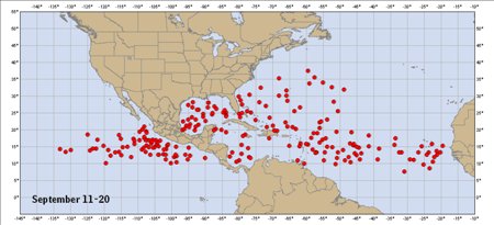
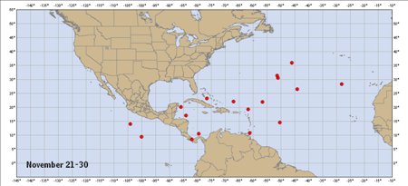
These maps show the points of origin (by 10-day periods) for named storms during years 1851 through 2009 for the Atlantic storm region.
Early season
Mid season
Late season
Typical hurricane paths
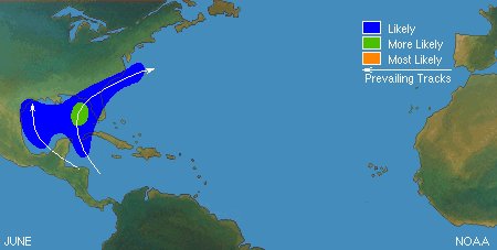
These maps show the zones of origin and typical hurricane paths through the hurricane season – clearly demonstrating that hurricanes originate and travel different paths during different months.
Early season
Mid season
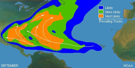
Late season
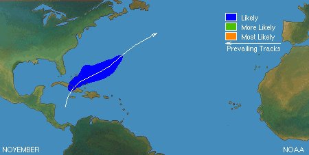
See Where is the Hurricane Zone for more information about traveling during hurricane season.

See every top plan priced for your trip
Enter your trip once and every top plan comes back side by side, priced for your dates. Same price as buying direct.
See plans & pricesAbout 60 seconds. Nothing to sign up for.Historical Hurricane Maps
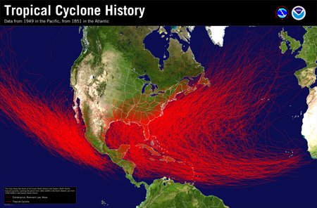
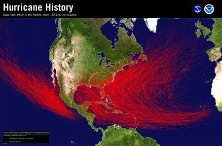
These maps show where hurricanes and tropical cyclones have historically occurred.
Tropical cyclone history
Hurricane history
Can you see hurricanes on Google Maps?
Google has added tools to their maps app to help travelers survive a natural disaster. Google isn’t in the weather business, but it’s tapping into official sources like the National Oceanic and Atmospheric Administration and Japan Meteorological Agency to track hurricanes.
In the days leading up to a hurricane, Google Maps will show you a visualization of the hurricane in their maps. This is known as a ‘hurricane forecast cone’ and it’s just like the ones you see on television weather forecasts.
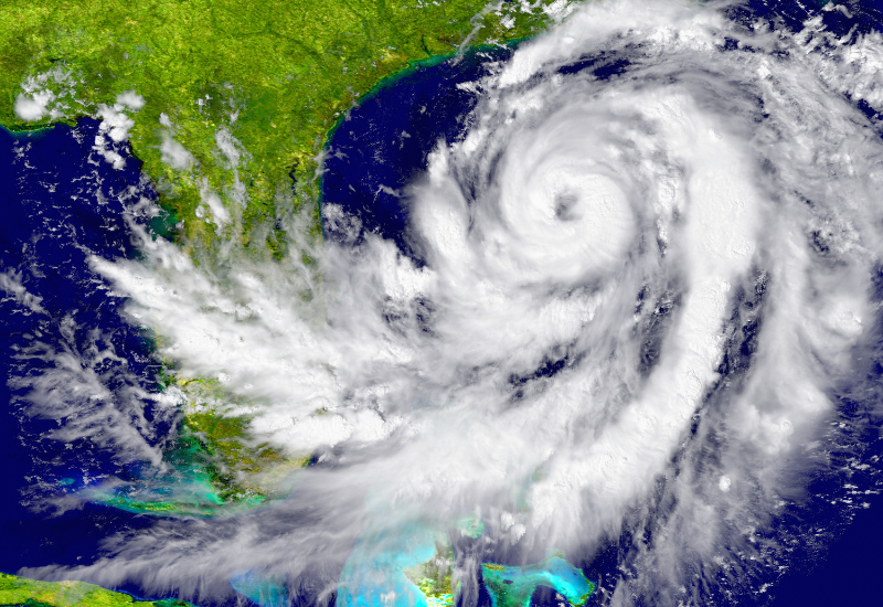
How do I see hurricanes on Google Earth?
Tropical cyclones are one of the most powerful and damaging storms that affect our planet. The strongest qualify as hurricanes and Google Earth will show a visualization of active tropical storms. The past, current, and projected path of an active hurricane is updated every 30 minutes.
The icon on the map will also display the severity level of the storm according to the Saffir-Simpson Hurricane Wind Scale.
The projected location of the storm is sown on the map as a blue cone, but hazardous conditions can occur outside the tracking area.
Google warns: the data is on a delay and should not be used as a real-time forecast or way to determine current safety conditions.
What is the best free hurricane tracking app?
While there are plenty of weather apps, hurricane tracking apps are different. Most can alert you when a storm is approaching your location. Hurricane tracking apps will also tell you the detailed forecast. If you, or someone you know, may be in danger of an impending hurricane, here are the best free tracking apps (according to Lifewire):
- Storm Radar (from The Weather Channel) – this one shows you exactly where the storm is moving.
- Hurricane (by the American Red Cross) – this one lets you track your loved ones and shows alerts.
- My Hurricane Tracker – this one lets you stay up-to-date on current storm changes.
Related:
See every top plan priced for your trip
Enter your trip once and every top plan comes back side by side, priced for your dates. Same price as buying direct.
See plans & pricesAbout 60 seconds. Nothing to sign up for.Related

Damian TysdalDamian Tysdal is the founder of CoverTrip and a licensed travel insurance agent since 2006. He believes travel insurance should be easier to understand, and started the first travel insurance blog in 2006. About CoverTrip.